
Ho Chi Minh City Deploys Map to Support Covid-19 Pandemic Prevention and Control
On the morning of 7th June, the Ho Chi Minh City Press Center and the City Departments of Information and Communications implemented a map to support preventing and controlling Covid-19 in the city.
In the first stage, via smart mobile phones or computers with an internet connection, people can search and detect problems relating to the Covid-19 epidemic around or at any location in the city. Meanwhile, the citizen can look up location information: Masks, medical facilities, essential places, etc., to meet the needs of daily life. The system also provides mapping tools for density analysis and statistics for leadership, management, monitoring, and epidemic prevention.
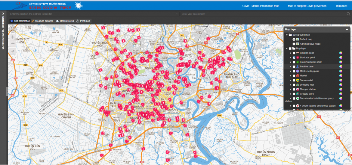
Figure 1: Blockade Points.

Figure 2: Epidemiological Points.
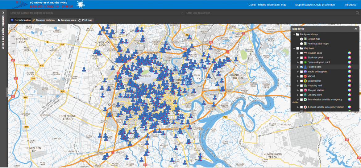
Figure 3: Positive Cases.
In the second stage, the Department of Information and Communications, in collaboration with HCDC, will upgrade and add a number of new functions: Information on epidemiological points, blockade points, positive cases published properties within a user-defined radius on the map, update map information of districts, wards, and communes that have taken samples for Covid-19 testing, as well as determine the location, find a way to build a suitable travel route, limit contact with points at risk of infection.
DIC expects the map to be an effective tool to support the prevention and control of the Covid-19 epidemic for people and managers. DIC will continue to develop the digital map of the Portal 1022 into a digital map that provides information and events of the city associated with the geographical location around the places people, organizations, and businesses are interested in. in order to ensure urban order and safety and to preserve civilization for the city.
(Source: People’s Army Newspaper Online)